


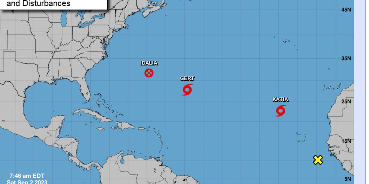
Idalia is expected to rapidly intensify as it moves through the Gulf of Mexico, soaking into some of the world’s warmest waters before reaching landfall in Florida this week.
If it happens, it would join a growing history of terrible hurricanes that have swiftly intensified before landfall in recent years, including Hurricane Ian, which destroyed coastal Florida and killed more than 100 people.
As it moves through the Gulf of Mexico, Idalia poses a “notable risk” of this phenomenon,
Rapid intensification has always been difficult to foresee, particularly when it comes to understanding where the overall threats and repercussions would be and how they will manifest. Andrew Kruczkiewicz, a senior researcher at Columbia University’s Columbia Climate School, cautioned that Idalia’s effects could extend beyond the point of landfall.
Storm surge, for example, may occur in and near the area where the storm makes landfall, while major rainfall-related risks might occur up to 100 miles distant.
“This is something that we’re seeing more and more, and it’s a climate change connection because we’re seeing wetter tropical cyclones and wetter hurricanes,” he told CNN. “As a result, we must pay closer attention to the risks associated with heavy precipitation, particularly in areas far from the coast.”
Here is a tweet about the Idalia Rapidly Intensifies Into a Major Hurricane. Catastrophic Storm Surge and Destructive Winds Expected in The Florida Big Bend Region This Morning When Idalia Moves Inland.


Storms are migrating farther inland than they were five decades ago, according to a 2020 study published in the journal Nature. Hurricanes, which generally weaken after crossing land, have been raging for longer in recent years. The study suggests that increased sea surface temperatures cause “slower decay” through increasing the moisture carried by hurricanes.
Idalia could threaten towns as far inland as Augusta, Georgia, and Columbia, South Carolina.
“These are inland areas where people from the coast may evacuate and believe they are safe, but there is a very high risk of flash flooding,” Kruczkiewicz added.
Because of the storm’s widespread effects, McNoldy advised not to focus on where the forecast cone is, but rather on what is forecast in your region.
“Pay attention to your hurricane watches, storm surge watches and warnings, and evacuations if you’re told to evacuate,” McNoldy said. “Hopefully, we’ve learned some lessons from last year.”
. This summer, water temperatures in certain regions of southern Florida reached 100 degrees Fahrenheit, and temperatures in the Gulf overall have been record-warm, with more than enough heat to allow rapid strengthening.
“1 to 2 degrees Celsius (roughly 2 to 3.5 degrees Fahrenheit) above normal for this time of year, which is a lot when you consider this is already a super-hot time of year,” said Brian McNoldy, an atmospheric scientist at the University of Miami. “With that in mind, and with those extra warm waters ahead of it, rapid intensification is more likely.”
Rapid Intensification is Now ‘More Likely
Rapid intensification is exactly what it sounds like when the winds of a storm develop rapidly over a short period of time. It is characterized by scientists as an increase in wind speed of at least 35 mph in 24 hours or less.
Concerningly, it has become increasingly common as storms near landfall, making them more difficult to plan for and more harmful to those who stayed behind expecting a smaller storm.
It’s just one of the ways the climate crisis, is making hurricanes more hazardous, as warmer oceans allow storms to strengthen faster. According to the National Oceanic and Atmospheric Administration, the oceans have accounted for more than 90% of global warming during the last 50 years.
Rapidly increasing storms were uncommon before recently. Historically, it took several days for tropical storms to develop into severe hurricanes, but with human-caused climate change, rapid intensification is becoming more prevalent, an assistant professor of atmospheric science at Florida State University.
Hurricane Franklin in the Atlantic Ocean experienced two periods of fast intensification, the most recent of which occurred from Sunday morning to Monday morning, when it developed from a 90-mph Category 1 hurricane to a 145-mph Category 4.
Here is a tweet about the Idalia Rapidly Intensifies Into a Category 4 Hurricane. Catastrophic Storm Surge and Destructive Winds Are Nearing The Florida Big Bend Region.
Hurricane #Idalia Advisory 14A: Idalia Rapidly Intensifies Into a Major Hurricane. Catastrophic Storm Surge and Destructive Winds Expected in The Florida Big Bend Region This Morning When Idalia Moves Inland. https://t.co/tW4KeGe9uJ
— National Hurricane Center (@NHC_Atlantic) August 30, 2023
“The frequency of rapid intensification cases has increased in recent years,” Wing told CNN. “While each storm has a unique set of circumstances, climate change makes the occurrence of strong hurricanes that rapidly intensify more likely.”
Two factors must be present for rapid intensification to occur: Along with warm ocean water, the upper-level winds surrounding the hurricane must be feeble. Strong winds can either prevent a storm from intensifying or split it apart.
“There will be some wind shear ahead of (the storm), which may limit its rapid intensification to just a little bit rather than a lot,” McNoldy said. “However, there is still that small component that can quickly intensify more than what the models show.”
More Dangerous Storms
Rapid intensification has always been difficult to foresee, particularly when it comes to understanding where the overall threats and repercussions would be and how they will manifest. Andrew Kruczkiewicz, a senior researcher at Columbia University’s Columbia Climate School, cautioned that Idalia’s effects could extend beyond the point of landfall.
Storm surge, for example, may occur in and near the area where the storm makes landfall, while major rainfall-related risks might occur up to 100 miles distant.
“This is something that we’re seeing more and more, and it’s a climate change connection because we’re seeing wetter tropical cyclones and wetter hurricanes,” he told CNN. “As a result, we must pay closer attention to the risks associated with heavy precipitation, particularly in areas far from the coast.”
Storms are migrating farther inland than they were five decades ago. Hurricanes, which generally weaken after crossing land, have been raging for longer in recent years. The study suggests that increased sea surface temperatures cause “slower decay” by increasing the moisture carried by hurricanes.
Idalia could threaten towns as far inland as Augusta, Georgia, and Columbia, South Carolina. “These are inland areas where people from the coast may evacuate and believe they are safe, but there is a very high risk of flash flooding,” Kruczkiewicz added.
Because of the storm’s widespread effects, McNoldy advised not to focus on where the forecast cone is, but rather on what is forecast in your region. “Pay attention to your hurricane watches, storm surge watches and warnings, and evacuations if you’re told to evacuate,” McNoldy said. “Hopefully, we’ve learned some lessons from last year.”
You can see the additional news below:
- Health Update: Kirsten Storms Shows Incredible Strength and Resilience Despite Her Struggles
- Hurricane Hilary Tracker: Category 4 Storm Forecast to Bring Heavy Rain
Follow us on our website The Current Online for more updates.